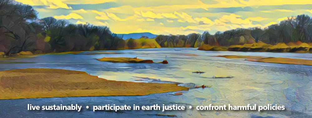
Valuable reading: The Office of the State Engineer is looking for feedback on NM Fifty year Water Plan. This is long but broken into segments which make for easier reading. Water experts wrote the various sections. https://geoinfo.nmt.edu/ClimatePanel/report/Climate_Change_and_Water_Resources-ForPublicComment_2021-09-16.pdf
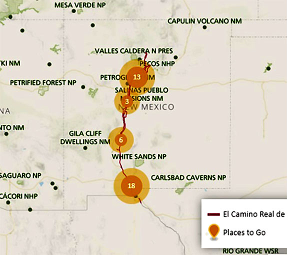
You have certainly heard about the National Parks and the National Forests, but how about the National Trails? There are two types of National Trails: the Recreational Trail System and the Historic Trail System.
The Rio Grande corridor’s National Historic Trail is El Camino Real de Tierra Adentro (the Royal Road of the Interior Land). This 404-mile trail basically goes from El Paso to Ohkay Owingeh and then continues on through Colorado via various branches. It follows a trade route that was used by indigenous people and later became the principal route to Mexico City for 300 years. The National Park Service, of which the Historic Trails are a part, have an app you may download thru the App Store or Google Play. You can listen to the history of a site at your current location or any other as you travel along. For example, in the mid Rio Grande, you can listen to the history of the Bosque del Apache National Wildlife Refuge, find the La Jornada del Muerto Trailheads, learn about the pueblo now called Coronado Monument, or stop to visit the Petroglyph National Monument.
As for recreational trails, however, the story of attempts to establish one in New Mexico goes back 6 years and is still ongoing. Former Governor Martinez promoted a bill in 2015 to create a commission to establish a viable path for the Rio Grande Trail. There is already a north-south recreational trail across New Mexico called The Continental Divide Trail, but the proposed new trail would be more accessible to hikers. There was to be a fund to carry out the work, but no monies were appropriated at the time.
The commission was appointed and met over the next few years. New Mexico’s Energy, Minerals and Natural Resources Department (EMNRD) and the federal Department of Transportation helped finance the commission’s consultation with a hiking-trail development group. The commission then approved the draft, rio grande trail-master plan-final changes.pdf, available on the EMNRD website. A community member walked over most of the projected 500-mile trail and brought practical problems to the commission to address before making decisions on the preferred alignment.
Problems which were encountered included accessing passage across private ranch land. There would need to be fencing, and who was to pay? Were there parallel paths which could be taken around some of the private areas? The pueblos have boundaries, but many of their sacred sites are on adjacent lands. How would they access these, and how would they keep sacred ceremonies from the intrusion of hikers? How would wildlife habitat be protected? Where would trail amenities be placed, such as water, restrooms, and camping sites? Would there be boat/raft pullouts along the trail? There was also the problem of which categories of users could access the trail…hikers, cyclists, riders of horses? No motorized vehicles would be allowed.
The planning went ahead, with various agencies and communities pledging segments of existing trails to the plan. Any community or organization designating trail has to also agree to its maintenance in their area. Segments of the trail traverse three national wildlife refuges, six national monuments, one national heritage area and six state parks. So far these, with various municipalities, have designated nearly 200 miles of trail. The trail head is proposed to be at Mount Cristo Rey near Las Cruces.
As Jeff Steinborn, sponsor of the original legislation said, “It’s going to take time but progress is being made.”
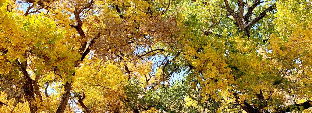
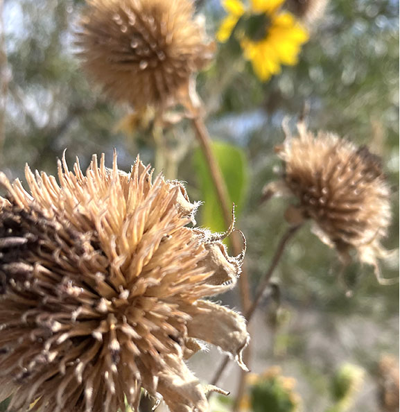
It is fall and we are waiting for the leaves to turn, be it maples at Fourth of July Campground, aspen at 7,000-9,000 feet, or cottonwoods in the bosque.
Bosque cottonwoods in the fall. Photo: Stephanie Klepacki / unsplash
There are three different pigments in leaves, but the green of chlorophyl blocks the other two during the long growing season of summer. Once the days start getting shorter and the nights longer, the chlorophyl pigment decreases. Then the carotenoid yellow/orange comes forth. Anthocyanin is the red pigment found in the maples. This color is also related to the sugars trapped in leaves.
Ideally, a wet late summer with a drier frost-free fall produces the best color. Autumn color is affected by tree health. Drought and insect damage to trees cause leaves to fall sooner. Leaves begin to drop as their veins become clogged with dying cells.
As ecological science has evolved, our understanding of how best to clean up gardens has changed. Diseased plants get removed, but instead of tidying up all the leaf fall and dead plants in Fall, we consider what insects and soil microbes need during the winter. It turns out that they survive better if leaves and dead stalks are left in place. For example, native bees hide out in places like hollow stems. Breaking off hollow sunflowers stems will give them winter shelter. Butterflies in all stages of their life cycle nestle down in leaf piles or hang onto dead plant stems. Ladybugs hibernate in bark and leaf piles. Birds search through leaf litter for bugs and spiders and love to find flower stalks with seeds. Once Spring temperatures get to 50 degrees for a week, the winter residents will start leaving. Then it’s time to clean up your garden!
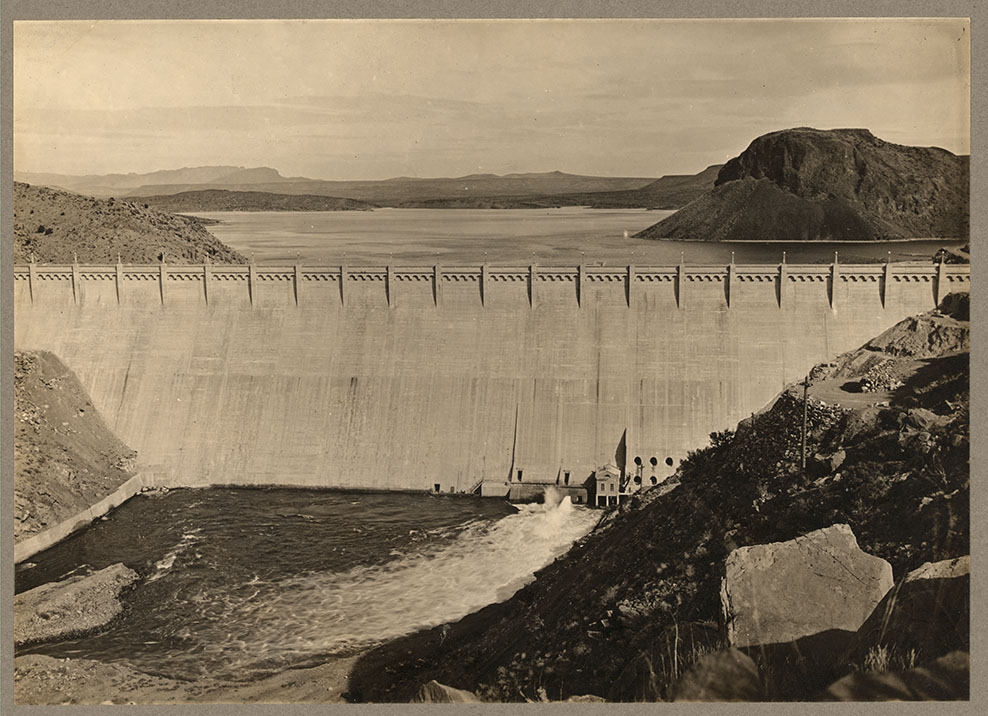
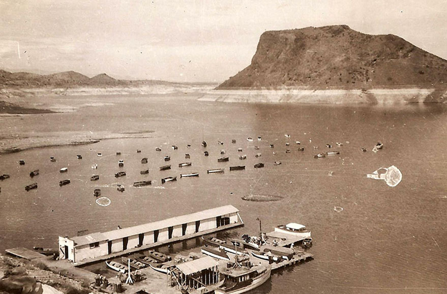
Right: Elephant Butte Dam in 1917 and marina in 1946. Photos: Library of Congress / Public Domain
Beginning in the 1880s, farmers in west Texas complained that the Rio Grande was down to a “trickle of water” during the summer. The blame was placed on the farmers upstream in New Mexico. The solution was to build a dam…but where to locate it and how to fund it would take the next 30 years.
Sites close to El Paso were considered first, but flooding the Mesilla Valley’s rich agricultural land seemed a bad idea. The northernmost site considered was Elephant Butte. A feasibility study done in 1902 settled the question, and Elephant Butte was chosen as the site.
Funding had been another question. British investors got involved in the 1890s but, due to delays, lost interest. The ultimate construction was U.S. funded with the idea that irrigators would over time pay off the costs. This never happened. Construction was finally started in 1911 and completed five years later. It was claimed to be the second largest irrigation dam in the world. What has happened since?