BURNED AREA EMERGENCY RESPONSE (BAER)

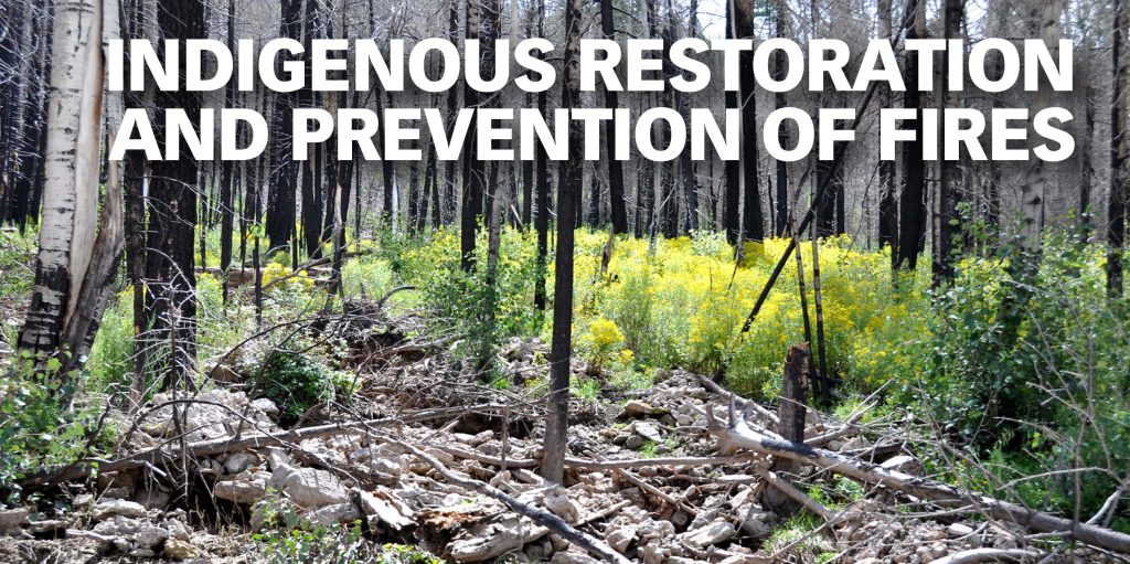
The past few months, most New Mexicans have been focused on our state’s two huge forest fires, the Hermit Peak Calf Canyon fire near Mora and Las Vegas and the Black fire in the Gila. Here in the mid Rio Grande, we are at risk for fires in both the Sandia and Manzano mountain ranges. Fortunately there have not yet been fires in our district this year, but forest fires farther “upstream” also affect the mid Rio Grande. For example, the Las Concho fire in the Jemez Mountains in 2011 turned the draining river black from ash, and the river carried that ash into the Rio Grande. And this is only one of the potential environmental impacts a forest fire can have long after it is contained. In this article, we explore how the National Forest Service (NFS) responds to the emergencies caused by the aftermath of a forest fire.

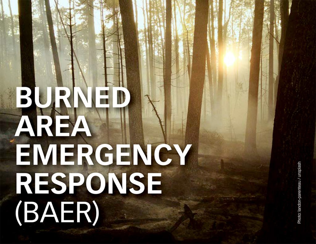
The Federal government has a post-fire emergency response, the Burned Area Emergency Response (BAER), designed to address problems on Federal land which pose a threat to human life, safety, property, or crucial natural or cultural resources. The BAER team assesses, prescribes, and develops a plan to minimize risks post-fire to stabilize soil and control water, sediment, and debris movement. “The public and communities adjacent to and downstream from wildfire areas should expect increased flooding and debris transport during less than average rain events,” according to the NM SW Region BAER safety message. This warning could easily be in effect for several years after a fire.

The BAER team is made up of hydrologists, soil scientists, engineers, biologists, botanists, archeologists, and others. Their assessment usually begins before the wildfire is totally contained. There are three phases to wildfire recovery: 1) Repair of the dozer fire lines, roads, trails, staging areas, and drop points used during fire suppression efforts (NFS responsible); 2) A plan for emergency stabilization of the burned area with recommended actions such as the installation of erosion and water run-off control structures, mulching, and seeding (NFS responsible); 3) Long term recovery, which can include restoring burned habitat, reforestation, and replacing burned fencing (the responsibility of coalitions of state and community organizations). In most cases, only a portion of the burned area is treated by the NFS, prioritizing steep slopes and places where water run-off would be excessive. Restoration of a “hot” fire is more hazardous; hardening the soil surface so water doesn’t penetrate and burning tree roots creating hidden holes in the terrain.   

The BAER assessment and plan must be developed within 7 days of total containment of the fire and submitted to the regional forest service office. The plan can be approved by them or, if it exceeds the limits of local authority, it is forwarded to Washington DC. Approval means funding is made available quickly for purchasing materials and contracting out services since soil stabilization and control of water runoff is critical before major storms occur. 

But what help is available for restoration if the fire scorches private land?

Continue reading

Indigenous Restoration and Prevention of Fires

Three years after the Las Conchas fire. Photo: Paul Asman and Jill Lenoble / Flikr. https://www.flickr.com/photos/pauljill/

Forest management has been a part of indigenous cultures since time immemorial. That has included selective harvesting of trees to maintain a balance of young and old, leaving enough food to meet the needs of wildlife, encouraging animal grazing in forests to keep the underbrush cleared, and allowing naturally-caused fires to burn. Currently, native nations that share geography with New Mexico have been working to restore land post-wildfire.

For years, the Santa Ana Pueblo has been collecting and germinating seeds of native plants. They sell these shrubs and trees at their store in Bernalillo. They also evaluate post-burn areas for the Forest Service, recommend the types of trees and shrubs that will grow well to reclaim an area, and respond to Requests For Proposals (RFP)s to provide the Forest Service with plants. Their nursery can provide plants in eight-inch trainers which take a year to mature in the nursery, one-gallon which mature in two years, five-gallon which mature in three to four years, all the way to 15-gallon containers which mature in four to six years. The bottom line is that it takes time to grow stock to reclaim forests after fire.

Pine Seedling. Photo: daiga ellaby / unsplash

Nearly 80% of the Santa Clara Pueblo’s forest land burned in the devastating Las Conchas fire in 2011. While many federal and other agencies had funds available for certain aspects of restoration, the Pueblo wanted to use their traditional ecological knowledge (TEK) for ecosystem restoration and natural materials in the process. They started the restoration at the top of their canyon and worked down its steep sides, stabilizing the side walls of stream beds and catching debris while letting stormwater filter through. This application of TEK earned them the Environmental Protection Agency (EPA) Least Impact Development (LID) Award in 2018.

Establishing an active seed-harvesting program was a part of this project. They collect seeds before they fall in the autumn. Seeds can be finicky; some like oak need to be planted within a month after harvest, while grass seeds can be stored up to 10 years. The Pueblo shares its seeds with the Jicarillo and Mescalero Apache tribal nurseries as well as the New Mexican State Extension Services at Mora. They have been able to plant 200,000 trees per year. Some of their restoration practices have been featured in a Scientific American article in 2021 as well as a PBS special.

Isleta Pueblo has a 10-year plan to use restoration ecology on their 2,200 acres of bosque. Part of their work is in conjunction with the Bureau of Reclamation. This year, their team is trying to remove invasive plants such as Siberian Elm, Salt Cedar, Russian Olive, and Arundo grass. The latter is a new invasive plant which grows 6-7 feet high, is used as food for elephants, and is extremely difficult to remove. They also use mechanical mastication for clearing and making mulch. Their goal is to re-establish connections between the now dry flood plain and the river. In other years, they have concentrated on fuel thinning in their forest land.

Laguna Pueblo is bordered on the east by the Rio Puerco. This river has a high sediment load which has rendered it hard to use for irrigation unless extensive restoration is done. The higher villages on the reservation still channel water from the mountains for their agriculture, The Bureau of Indian Affairs has helped the Pueblo with thinning and establishing fire breaks on their forested lands.

Sandia Pueblo has concentrated on prevention of fire along their stretch of bosque. They have a herd of goats and deploy them in the bosque as well as letting them graze the Pueblo grasslands.

Article written with the help of foresters from the different Pueblos, by Sue Brown

HEAT ISLANDS

Photo: tools for motivation / unsplash

Heat islands are found in urban areas that experience higher temperatures than outlying areas – the difference can be eight to ten degrees Fahrenheit. The sun’s rays are absorbed by buildings and particularly black asphalt. Heat islands are formed where greenery is limited and there is increased density in housing. These conditions are often found in areas of low-income housing.

Heat can cause exhaustion, swelling. cramps. and even death. Heat is the leading weather-related killer in the US, with a related death rate from 0.5 to 2.0 per million between 1979 and 2018. Heat-related deaths (when body temperature exceeds 104℉) and heat-related illnesses (HRI) are almost certainly under-reported. At-risk populations include people with incomes below the federal poverty level who have fewer options to be safe during a heat wave, older adults who may have underlying illnesses, the very young who are dependent on others to keep them cool and hydrated, and people with disabilities who cannot get to cooler places. The EPA has an informative booklet on Heat Islands.

In New Mexico, the Department of Health’s Division of Epidemiology keeps our state’s data. New Mexico is warming faster than originally predicted and is the second fastest warming state in the US. The number of days of statewide average temperatures greater than 90℉ is growing at the rate of one day per year, according to the National Oceanic and Atmospheric Administration; it is predicted to be 104 days this year.

Heat waves have various regional definitions, from temperatures hotter than the historical average for more than two days to temperatures greater than 90℉ for five days to a series of days with temperatures greater than 100℉. Using any definition, heat waves are predictable with today’s weather tools. So how do we prepare to help our most vulnerable living in Albuquerque’s heat islands?

The city of Albuquerque contracted with CAPA Strategies to do a city-wide study of heat at two different times of day and at locations along heavily-trafficked and public-transportation routes. Volunteers walked, rode bikes, or drove over assigned routes using standardized equipment to record measurements. The amount of heat was rated from high to low and mapped out.

Unsurprisingly, the most heavily trafficked streets and intersections were the hottest, especially along corridors adjacent to I 25 and I 40. While there are heat vulnerabilities in many places in the city, downtown. Wells Park, and the International District tend toward greater heat. The city environmental department and some other branches of city government are meeting monthly on this problem, but the only ideas made public at this time are planting more trees and the consideration of cool pavement coatings for heavily-used streets.

When will we learn more of the city’s plans, especially as they relate to needed changes in building codes and to emergency protections such as cool shelters for the vulnerable during heat waves? by Sue Brown