Book Review: Drawdown

Drawdown: The Most Comprehensive Plan Ever Proposed to Reverse Global Warming, edited by Paul Hawkin

As the subtitle claims, this is truly a comprehensive plan to reverse global warming. The book provides 100 scenarios to reduce greenhouse gas emissions and/or sequester carbon. The upfront costs and ultimate cost savings of changing behavior are also analyzed. Each strategy is based on global data. Sixty-one research scientists across the globe with expertise in environmental issues collaborated on the solutions. The narrative of each of the scenarios is only 2-3 pages with illustrative photos included with each article. All are accessibly written for the lay reader.

An example of a scenario is farmland restoration. A study from Stanford University suggests there are approximately one billion acres of land abandoned globally. Ninety-nine percent of this desertion occurred in the last century. Restorative practices such as perma-gardening, which integrates water saving, soil fertility, and companion planting, can result in active restoration of the land. Such approaches require funding and are labor intensive if done on a large scale, but the overall effectiveness of farmland restoration is huge. It would increase carbon sequestration by gigatons and produce additionally billion of tons of food.

Nuclear energy is ranked 20th in effectiveness out of the 100 strategies. However, it is alone in being categorized as having “regrets”; the other strategies are listed as “no regrets.” While producing nuclear energy leads to a decrease in carbon impact, it also introduces a risk of tritium release, abandoned uranium mines, mine-tailing pollution, the challenge of disposing spent nuclear waste, illicit plutonium trafficking, and the need to guard nuclear waste for thousands of years.

While our current situation is traumatic to think about, the book is hopeful. Each environmental problem is exposed but combined with solutions.

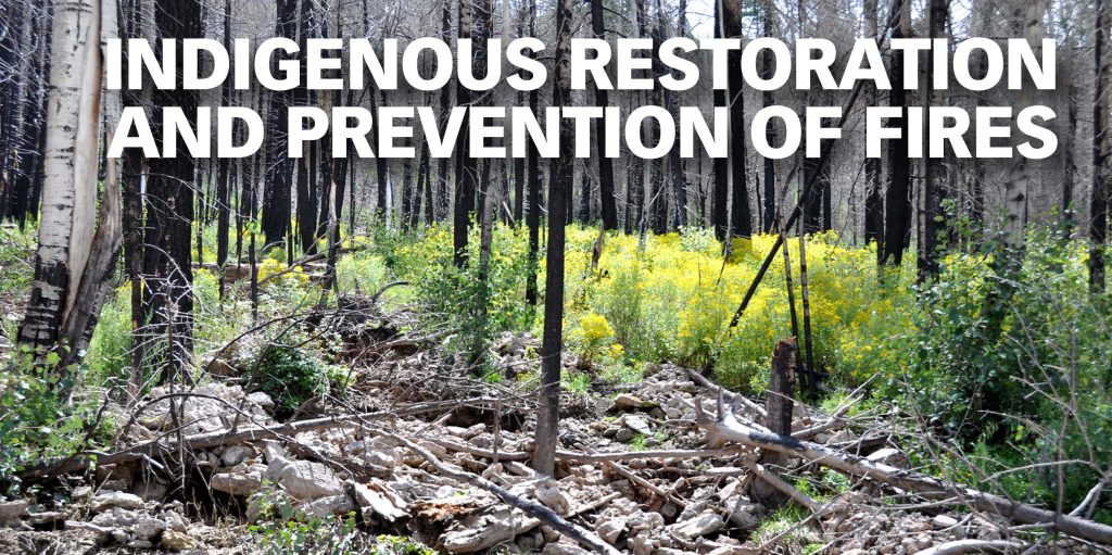
Indigenous Restoration and Prevention of Fires

Three years after the Las Conchas fire. Photo: Paul Asman and Jill Lenoble / Flikr. https://www.flickr.com/photos/pauljill/

Forest management has been a part of indigenous cultures since time immemorial. That has included selective harvesting of trees to maintain a balance of young and old, leaving enough food to meet the needs of wildlife, encouraging animal grazing in forests to keep the underbrush cleared, and allowing naturally-caused fires to burn. Currently, native nations that share geography with New Mexico have been working to restore land post-wildfire.

For years, the Santa Ana Pueblo has been collecting and germinating seeds of native plants. They sell these shrubs and trees at their store in Bernalillo. They also evaluate post-burn areas for the Forest Service, recommend the types of trees and shrubs that will grow well to reclaim an area, and respond to Requests For Proposals (RFP)s to provide the Forest Service with plants. Their nursery can provide plants in eight-inch trainers which take a year to mature in the nursery, one-gallon which mature in two years, five-gallon which mature in three to four years, all the way to 15-gallon containers which mature in four to six years. The bottom line is that it takes time to grow stock to reclaim forests after fire.

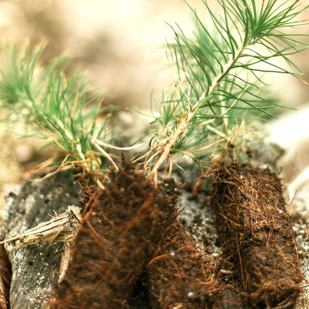
Pine Seedling. Photo: daiga ellaby / unsplash

Nearly 80% of the Santa Clara Pueblo’s forest land burned in the devastating Las Conchas fire in 2011. While many federal and other agencies had funds available for certain aspects of restoration, the Pueblo wanted to use their traditional ecological knowledge (TEK) for ecosystem restoration and natural materials in the process. They started the restoration at the top of their canyon and worked down its steep sides, stabilizing the side walls of stream beds and catching debris while letting stormwater filter through. This application of TEK earned them the Environmental Protection Agency (EPA) Least Impact Development (LID) Award in 2018.

Establishing an active seed-harvesting program was a part of this project. They collect seeds before they fall in the autumn. Seeds can be finicky; some like oak need to be planted within a month after harvest, while grass seeds can be stored up to 10 years. The Pueblo shares its seeds with the Jicarillo and Mescalero Apache tribal nurseries as well as the New Mexican State Extension Services at Mora. They have been able to plant 200,000 trees per year. Some of their restoration practices have been featured in a Scientific American article in 2021 as well as a PBS special.

Isleta Pueblo has a 10-year plan to use restoration ecology on their 2,200 acres of bosque. Part of their work is in conjunction with the Bureau of Reclamation. This year, their team is trying to remove invasive plants such as Siberian Elm, Salt Cedar, Russian Olive, and Arundo grass. The latter is a new invasive plant which grows 6-7 feet high, is used as food for elephants, and is extremely difficult to remove. They also use mechanical mastication for clearing and making mulch. Their goal is to re-establish connections between the now dry flood plain and the river. In other years, they have concentrated on fuel thinning in their forest land.

Laguna Pueblo is bordered on the east by the Rio Puerco. This river has a high sediment load which has rendered it hard to use for irrigation unless extensive restoration is done. The higher villages on the reservation still channel water from the mountains for their agriculture, The Bureau of Indian Affairs has helped the Pueblo with thinning and establishing fire breaks on their forested lands.

Sandia Pueblo has concentrated on prevention of fire along their stretch of bosque. They have a herd of goats and deploy them in the bosque as well as letting them graze the Pueblo grasslands.

Article written with the help of foresters from the different Pueblos, by Sue Brown

HEAT ISLANDS

Photo: tools for motivation / unsplash

Heat islands are found in urban areas that experience higher temperatures than outlying areas – the difference can be eight to ten degrees Fahrenheit. The sun’s rays are absorbed by buildings and particularly black asphalt. Heat islands are formed where greenery is limited and there is increased density in housing. These conditions are often found in areas of low-income housing.

Heat can cause exhaustion, swelling. cramps. and even death. Heat is the leading weather-related killer in the US, with a related death rate from 0.5 to 2.0 per million between 1979 and 2018. Heat-related deaths (when body temperature exceeds 104℉) and heat-related illnesses (HRI) are almost certainly under-reported. At-risk populations include people with incomes below the federal poverty level who have fewer options to be safe during a heat wave, older adults who may have underlying illnesses, the very young who are dependent on others to keep them cool and hydrated, and people with disabilities who cannot get to cooler places. The EPA has an informative booklet on Heat Islands.

In New Mexico, the Department of Health’s Division of Epidemiology keeps our state’s data. New Mexico is warming faster than originally predicted and is the second fastest warming state in the US. The number of days of statewide average temperatures greater than 90℉ is growing at the rate of one day per year, according to the National Oceanic and Atmospheric Administration; it is predicted to be 104 days this year.

Heat waves have various regional definitions, from temperatures hotter than the historical average for more than two days to temperatures greater than 90℉ for five days to a series of days with temperatures greater than 100℉. Using any definition, heat waves are predictable with today’s weather tools. So how do we prepare to help our most vulnerable living in Albuquerque’s heat islands?

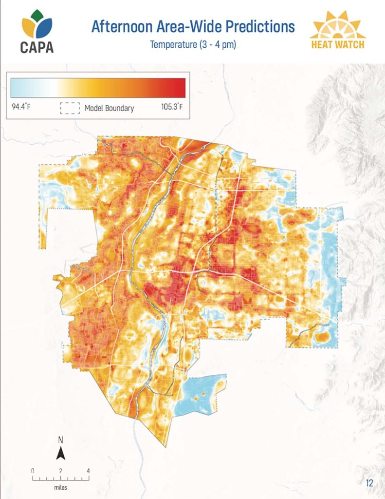
The city of Albuquerque contracted with CAPA Strategies to do a city-wide study of heat at two different times of day and at locations along heavily-trafficked and public-transportation routes. Volunteers walked, rode bikes, or drove over assigned routes using standardized equipment to record measurements. The amount of heat was rated from high to low and mapped out.

Unsurprisingly, the most heavily trafficked streets and intersections were the hottest, especially along corridors adjacent to I 25 and I 40. While there are heat vulnerabilities in many places in the city, downtown. Wells Park, and the International District tend toward greater heat. The city environmental department and some other branches of city government are meeting monthly on this problem, but the only ideas made public at this time are planting more trees and the consideration of cool pavement coatings for heavily-used streets.

When will we learn more of the city’s plans, especially as they relate to needed changes in building codes and to emergency protections such as cool shelters for the vulnerable during heat waves? by Sue Brown

Drought:

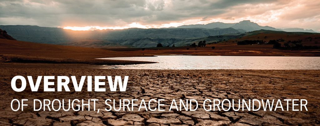
According to National Oceanic and Atmospheric Agency (NOAA), this area has been in increasing drought for years. “Drought intensity is projected to increase and snow-pack accumulation is projected to decrease which will pose a major challenge to NM environmental, agricultural and human systems.”

Drought is more than decreased snow/rainfall. It is important to combine it with temperature change. Increases in the latter effects the rate of evaporation from reservoirs, lakes and streams as well as the melting characteristics of snowpack. This combination of decreased precipitation and increased heat are the major contributors to our decreasing soil moisture. While the future amount of precipitation is hard to estimate, it is thought it will be erratic and therefore less predictable in amount and timing. The increase in heat in NM over the past 50 years has been two degrees and by some is estimated to at least reach a total of five degrees increase by 2060. This increase is in both daytime and nighttime temperatures.

SURFACE WATER

Surface water is what you see in reservoirs, lakes, rivers, arroyos, and streams. Surface water through millennium has filtrated through fissures in rock and formed larger collections of water underground called groundwater or aquifers.

In order to understand surface water, gauges have been set up all along the Rio Grande. The first one was established in 1886 at Otowi Bridge. The gauges measure amount of water and flow rates. They are monitored by the US Geological Survey. The information gathered by gauges determines the amount of surface water CO delivers to NM and that we then deliver to TX (which starts at Elephant Butte dam)

Most rivers world-wide and in New Mexico, run sporadically. These often do not have gauges to measure the amount of water when it are flowing. This gap in data makes it difficult for water managers to assess the amount of surface water we have and whether it will be adequate to recharge the aquifer. “Understanding how the drought is affecting water resources in NM really depends on our ability to know surface water resources,” according to George Allen, hydrologist at Texas A & M.

The Bureau of Reclamation controls the dams and the reservoirs of surface water behind them. In NM the major dams are at El Vado, Cochiti, and Elephant Butte. Because of increasing drought in the SW, the Bureau has restricted Colorado River water in various states. For example, in AZ, they enacted Tier 1 restriction in 2021 and are about to move to Tier 2 which will farther reduce the availability of water for agricultural and municipal drinking water supplies. Will they need to do this in NM? The average effective life of a dam is 70 years before silt decreases its effectiveness. Elephant Butte reservoir is now at only 14% of capacity and evaporating at a faster rate because of increasing temperatures. Its hydropower generators run only a few months of the year. Texas is currently suing NM in the Supreme Court for taking too much water south of this dam for our chili and pecan industries. What is the future of this dam?

GROUND WATER

Ground water (or aquifers) only exist because of surface water. Aquifers are defined as a body of water in rock fractures (spaces) where water can move freely since it is restricted by layers of non-porous clay or rock above and below. Surface water must recharge ground water when it is pumped out in order to keep a constant amount in an aquifer. In other words, there is no underground lake like we thought in the 1960s, only pockets of water contained in rock fissures! This water can move horizontally, diagonally, vertically, but usually downhill because of the force of gravity.

The recharge of aquifers is done mainly from snow and rainfall which becomes surface water before becoming ground water.

Levels of groundwater are more difficult to measure than surface water. The NM Collaborative Groundwater Monitoring Network attempts to do this. Over 400 operators of wells across NM as municipalities or private well owners agree to measure the level of water in their well at a set frequency, at least annually. This data is sent to the NM Bureau of Geology and Mineral Resource where it is then aggregated to give an overall picture of available water in various areas of the state. It is reported as stable or as a decline rate. The total volume of water in an aquifer is unknown.

The most common device to measure the depth of water is a steel tape dropped into a well and noting the distance from ground surface to the point where the tape first contacts water. In the mid Rio Grande basin, there are many well operators and owners cooperating, but in other part of the state, data is lacking. There are also some less widely used ways of monitoring devices as air-line and electronic and sonic meters. Satellites can tell the big picture, ie., the decreasing size of the Ogalala Aquifer but are not used for monitoring smaller aquifers.

As groundwater decreases in an aquifer, at a certain point the quality of the water decreases and becomes brackish. The remaining water is higher in Total Dissolved Solids (TDS) often reported as increased salinity. Another example of decreasing quality of groundwater is an increased level of Arsenic, especially in areas of sedimentary and volcanic rock. The EPA standard is less than 10 parts per billion. According to the recent ABCWUA report, our treated drinking water is well below at 1.3 parts per billion due to their good treatment.

ABCWUA provides our drinking water from a combination of surface and pumped ground water. In the last several years, the use of ground water has increased to 71% of our total drinking water. If the ground water is not recharged this pumping is unsustainable.

by Sue Brown

ALBUQUERQUE BERNALILLO COUNTY WATER UTILITY AUTHORITY (ABCWUA) RESPONSE TO DROUGHT.

ABCWUA has accomplished this by an education campaign combined with the promotion of low flow shower heads and low flush toilets. Rebates were offered which are now phased out.

At the same time, ABCWUA has aimed to decrease outdoor use of water. ABCWUA began publishing a colorful 50-page guide called “Xeriscaping: The Complete How-To Guide.” The free guide covers drip irrigation, mulching, and more xeric types of trees, shrubs, vines, flowers, and groundcovers. Rebates for certain types of trees are still being offered. Currently, 62% of the water processed by ABCWUA goes to indoor use and 38% to outdoor uses.

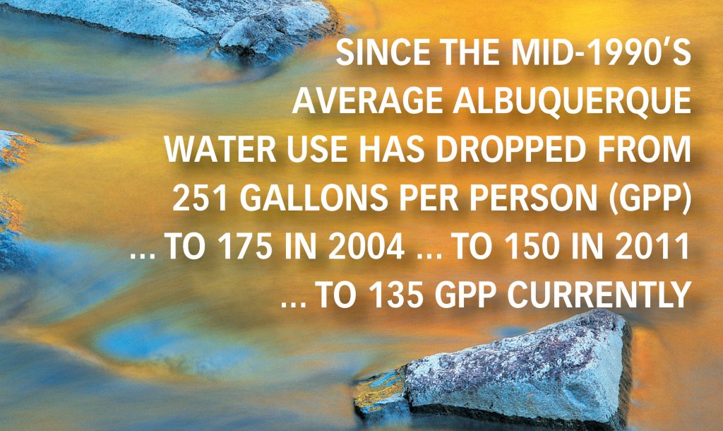
In 2016, ABCWUA wrote a 100-year plan, ‘Securing our Water Future,’ also known as the 2120 Plan. A new goal was set of 110 gpp, pd by 2037. In order to accomplish this, they have been emphasizing ways to decrease outdoor usage. ABCWUA now has a monthly garden newsletter, Water Smart workshops online, and efficiency initiatives, including promotion of organic groundcovers. Some of these approaches have rebates. The Water Action Plan (https://www.abcwua.org/wp-content/uploads/2020/11/wqppap.pdf) is reviewed annually and updated every 10 years and is probably the best source of any current information.

ABCWUA is also using new technology to recharge the aquifer. Thirty percent of the groundwater pumped from the aquifer is being returned as treated wastewater. A pilot project is underway using treated wastewater on some landscaping in parks and a golf course.

ABCWUA has a Governing Board made up of elected members from the city council and county commission that meets monthly. There is no requirement for members to have knowledge about climate or hydrology. The Governing Board has two advisory boards: the Water Protection Advisory Board is tasked with issues around the quality of our water; the Technical Customer Advisory Committee solicits advice and recommendations from customers.

The Governing Board has the responsibility to declare various levels of drought which will then initiate changes in ABCWUA policies. So far, no declaration of drought has been made.

The ABCWUA publishes updates to its 2120 Water Conservation Plan. The updates are required every 10 years and reviewed annually. On the same webpage, you can sign up for the Water Conservation monthly newsletter.

OPTIONS FOR MORE RESPONSES TO WATER CONCERNS IN OUR REGION

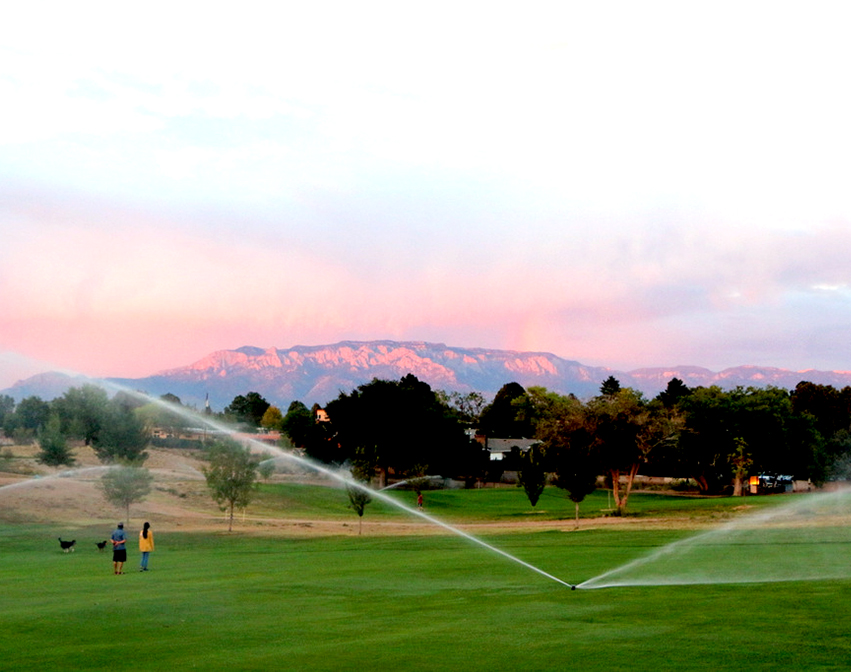
The City of Albuquerque is running a pilot using recycled water on certain golf courses and parks in the South Valley. This mitigates use of potable water. This raises the question of whether city and county zoning could require grey water for landscaping on all future building permits, as Tuscon does.

The City has extensive parks and golf courses which need water.
Photo: Roger Harmon

In Sandoval county many agencies have come together to build the Harvey Jones Bioswale Demonstration Project as a Green Infrastructure Initiative (GSI). They have basically constructed a curving path for stormwater runoff into a wetland so there will be aquifer recharge rather than the water going straight into the river. No concrete is being used for channels. Where else can concrete be removed from diversion channels to permit stormwater to permeate into the aquifer?

The ABCWUA 2120 plan sets a goal to decrease water usage from the current 127 gallons per person/day to 110 by 2036. Could this be moved up by ABCWUA, or at least by individual households? And could there be free audits to help the homeowner comply, or fines to convince them? And what about the number of trees a property has in place to sequester carbon and provide cooling shade…can their watering be credited in the calculation of household water use?

Could less effective dams be shut down? Up to 30% of stored surface water evaporates annually, so shutting down dams such as the 110-year-old Elephant Butte dam might help New Mexico meet its surface water obligations to Texas. But…how would shutting the dam down affect recreation and irrigation of chili and pecans?

The cities of Rio Rancho, Albuquerque, Bernalillo, Los Lunas, and Socorro and the tribes of Cochiti, Kewa, San Felipe, Tamaya, Sandia, Laguna, and Isleta all have a voice in decisions about the mid Rio Grande watershed. State agencies as the NM Environmental Department and the Interstate Stream Commission, regional agencies as the Mid Rio Grande Conservancy District and the Soil and Water and Conservation District, and the acequia societies all have important roles. Federal agencies as the EPA (mainly water quality), USGS (mainly gauges for measurements of water flow), and Bureau of Reclamation (mainly dam construction and management) have critical roles. And then there is the Rio Grande Compact, an interstate treaty between Colorado, New Mexico, and Texas, approved by Congress in 1938. The Compact determines how much water each of the three states will be allotted according to certain water flow gauges along the river.

Melanie Stansbury has currently introduced a bill in the US House, with a companion bill in the Senate, to get all these entities at the same table to study the issues of the Rio Grande and its basin as it flows through the three states and into the Gulf of Mexico. Hearings on this bi-partisan bill are expected to begin this summer and fall.

What are some other ideas you have heard of or thought of to better address the problem of drought and potential water shortages in the mid Rio Grande?

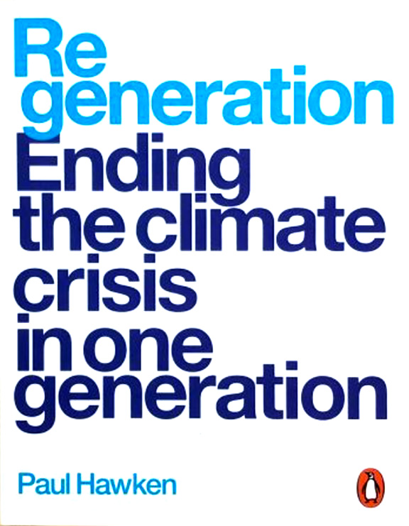
REGENERATION – book review

 by Paul Hawken, Penguin Books, 2021.  Reviewed by Esther Jantzen

This is a book you can safely (without much pushback) give to almost anyone with almost any opinion about climate change. Ask them to pick a topic from the table of contents and read two pages. On its own, Regeneration will persuade them that the climate crisis is real, that there’s plenty we can do collectively and individually to address the issues, that all over the world people are taking actions that make a difference, and that they, too, can take heart and take action.

That’s the value of this book: its power to quickly inform, shock, and inspire actions toward climate solutions.

Regeneration addresses the main domains in which we—the people on earth at this time—must make change: oceans, forests, wilding, land, people, cities, food, energy, and industry. With each domain, there are two-to-three page essays on subtopics, with photos, definitions, descriptions, facts, numbers, statistics, and dates. I doubt if there’s a better resource of talking points for a lay-person.

Who knew the small azolla fern can sequester carbon, replace fertilizers, and provide animal feed? Who knew bamboo could be food and fuel for people, as well as used for buildings, motorcycle helmets, fabrics, and toilet paper? Who knew beavers were a keystone species for water restoration? That worm vermiculture can lead to a 25% increase in crop yield? That a forest is already a farm? That, by design, buildings can generate more clean water and clean energy than they use? That humans use 59% of crop land to grow food for livestock? That a platform in the sea can generate energy from waves, sun, and the wind simultaneously? That democracies can be regenerated by local and state voter action?

Best of all for me is that Hawken and his extensive staff have researched places around the globe where ordinary people have successfully innovated and implemented surprising, often simple, solutions. The focus of most of these, of course, is related to how to draw down the extremely dangerous excess carbon in the atmosphere, sequester it, educate people, and prevent more release of carbon through persuading the oil and gas industry to keep fossil fuels in the ground.

While almost all of the essays would get an A from me, I did find some unevenness, with a few less clear, less satisfying. And the binding on this oversize book, published by Penguin, didn’t hold well. But I’m willing to forgive on both counts, for the good in this book far outweighs its defects.

For most readers, the rub in all these ideas comes when we consider our own responsibility to take action. What can little old me do, an urban apartment renter who doesn’t own a farm where I can implement innovation and build up the soil?

To push ourselves, my Elder Activist Readers book group responded to the prompt: “Out of having read this book, I will…” Here are some of the ideas which emerged:

—review my financial portfolio to make sure I’m not invested in fossil fuel companies
—create more conversations with people about climate issues.
—change my diet to be more plant-based
—order bamboo toilet paper rather than tree-logged products
—rethink the donations I make
—investigate getting a heat pump
—convert our house to all electric appliances
—renew my commitment to simplify my life
—get rid of stuff, perhaps including our third car
—use less heat
—think about what I can do with my land and property
—research ideas for sustainable gardening
—research trees whose leaves you can eat
—learn and talk about Big Food, Big Pharma, Big Medicine, and Big Poverty
—take my own containers to restaurants for left-overs
—think about how to live without so much plastic
—get an electric car
—buy fewer clothes, and when I do, buy used clothing
—transfer my investment to Green Century funds
—plant more trees, especially fruit trees, in our back yard
—give copies of Regeneration to the managers of grocery stores I use, to my political representatives, to a neighbor, to the local adult education organization, and to a library.

I’m sure you will have more ideas when you read this book. !Si, se puede! Yes, you can!